Category:Shodo Island
Jump to navigation
Jump to search

island in Seto Inland Sea, Japan   | |||
| Upload media | |||
| Instance of | |||
|---|---|---|---|
| Located in protected area | |||
| Location | Shōzu district, Kagawa Prefecture, Japan | ||
| Located in or next to body of water | |||
| Highest point |
| ||
| Area |
| ||
| Different from | |||
| official website | |||
 | |||
| |||
Subcategories
This category has the following 2 subcategories, out of 2 total.
R
S
Media in category "Shodo Island"
The following 48 files are in this category, out of 48 total.
.jpeg/120px-From_Ropeway_At_Shodoshima_(185211083).jpeg) From Ropeway At Shodoshima (185211083).jpeg 2,048 × 1,365; 954 KB
From Ropeway At Shodoshima (185211083).jpeg 2,048 × 1,365; 954 KB
 Harima-Nada 1.png 1,203 × 921; 755 KB
 Monument of Shikoku Northernmost.JPG 3,648 × 2,736; 3.74 MB
 Shakagahana-enchi:釈迦ヶ鼻園地 - panoramio.jpg 720 × 480; 79 KB
 ShodoIslands background in M.t Ayabe.JPG 2,784 × 152; 218 KB
 Shodoshima 01.jpg 1,280 × 960; 400 KB
 Shodoshima Island Kagawa Japan.jpg 3,063 × 855; 1.15 MB
 Shyoudoshima,Kagawa - panoramio.jpg 1,990 × 1,325; 1.13 MB
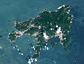
 Shōdoshima Relief Map, SRTM-1.jpg 1,200 × 900; 330 KB
 Syodoshima Express Ferry.jpg 615 × 461; 60 KB
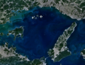
 Syodoshima landsat.jpg 892 × 677; 152 KB
 Syoudosima01.jpg 1,600 × 186; 175 KB
 こまめ食堂様・夏 - panoramio.jpg 1,600 × 1,200; 1.01 MB
.jpg/80px-アルナカラーサッシ_2010_(6453346907).jpg) アルナカラーサッシ 2010 (6453346907).jpg 2,592 × 3,872; 4.19 MB
アルナカラーサッシ 2010 (6453346907).jpg 2,592 × 3,872; 4.19 MB
_-_panoramio.jpg/120px-千枚田(Thousand%27s_fields)_-_panoramio.jpg) 千枚田(Thousand's fields) - panoramio.jpg 1,600 × 1,200; 850 KB
千枚田(Thousand's fields) - panoramio.jpg 1,600 × 1,200; 850 KB
 大坂城築城残石八人石 - panoramio.jpg 1,600 × 900; 417 KB
.jpg/120px-寒霞溪_-_纜車券_(34243551476).jpg) 寒霞溪 - 纜車券 (34243551476).jpg 6,000 × 4,000; 9.81 MB
寒霞溪 - 纜車券 (34243551476).jpg 6,000 × 4,000; 9.81 MB
.jpg/120px-小豆島_-_panoramio_(1).jpg) 小豆島 - panoramio (1).jpg 1,600 × 900; 247 KB
小豆島 - panoramio (1).jpg 1,600 × 900; 247 KB
 小豆島 - panoramio.jpg 1,600 × 900; 203 KB
 小豆島 三都半島 - panoramio.jpg 4,000 × 3,000; 2.53 MB
 小豆島ナガ崎 - panoramio.jpg 1,600 × 900; 319 KB
 小豆島ハヤ崎 - panoramio.jpg 1,600 × 900; 198 KB
 小豆島北浦 - panoramio.jpg 1,600 × 900; 143 KB
 小豆島南風台 - panoramio.jpg 1,600 × 900; 222 KB
 小豆島吉田 - panoramio.jpg 1,600 × 900; 212 KB
 小豆島城ヶ島 - panoramio.jpg 1,600 × 901; 86 KB
 小豆島大部 - panoramio.jpg 1,600 × 900; 268 KB
.jpg/120px-小豆島小部_-_panoramio_(1).jpg) 小豆島小部 - panoramio (1).jpg 1,600 × 901; 267 KB
小豆島小部 - panoramio (1).jpg 1,600 × 901; 267 KB
 小豆島小部 - panoramio.jpg 1,600 × 900; 181 KB
 小豆島尾形崎 - panoramio.jpg 1,600 × 900; 243 KB
 小豆島岩谷 - panoramio.jpg 1,600 × 901; 182 KB
.jpg/120px-小豆島採石場_-_panoramio_(1).jpg) 小豆島採石場 - panoramio (1).jpg 1,600 × 900; 225 KB
小豆島採石場 - panoramio (1).jpg 1,600 × 900; 225 KB
.jpg/120px-小豆島採石場_-_panoramio_(2).jpg) 小豆島採石場 - panoramio (2).jpg 1,600 × 900; 201 KB
小豆島採石場 - panoramio (2).jpg 1,600 × 900; 201 KB
.jpg/120px-小豆島採石場_-_panoramio_(3).jpg) 小豆島採石場 - panoramio (3).jpg 1,600 × 901; 396 KB
小豆島採石場 - panoramio (3).jpg 1,600 × 901; 396 KB
 小豆島採石場 - panoramio.jpg 1,600 × 900; 283 KB
.jpg/80px-小豆島橄欖公園_(33473640723).jpg) 小豆島橄欖公園 (33473640723).jpg 4,000 × 6,000; 26.06 MB
小豆島橄欖公園 (33473640723).jpg 4,000 × 6,000; 26.06 MB
 小豆島橘峠 - panoramio.jpg 1,600 × 900; 249 KB
 小豆島池田 - panoramio.jpg 1,600 × 900; 211 KB
.jpg/120px-小豆島池田港_-_panoramio_(1).jpg) 小豆島池田港 - panoramio (1).jpg 1,600 × 901; 144 KB
小豆島池田港 - panoramio (1).jpg 1,600 × 901; 144 KB
 小豆島池田港 - panoramio.jpg 1,600 × 900; 150 KB
 小豆島金ヶ崎 - panoramio.jpg 1,600 × 900; 196 KB
 小豆島長浜 - panoramio.jpg 1,600 × 900; 121 KB
.jpg/120px-岬の分教場_-_panoramio_-_米田賢一_(1).jpg) 岬の分教場 - panoramio - 米田賢一 (1).jpg 2,496 × 1,664; 1.14 MB
岬の分教場 - panoramio - 米田賢一 (1).jpg 2,496 × 1,664; 1.14 MB
 棚田の稲穂 - panoramio.jpg 1,600 × 1,200; 893 KB
 瀬戸内海と小豆島 - panoramio.jpg 1,600 × 900; 72 KB
 瀬戸内海小豆島 - panoramio.jpg 1,600 × 900; 136 KB
.jpg/80px-瓦番_寒霞溪_(34283894195).jpg) 瓦番 寒霞溪 (34283894195).jpg 4,000 × 6,000; 24.32 MB
瓦番 寒霞溪 (34283894195).jpg 4,000 × 6,000; 24.32 MB
.jpg/120px-高松港_-_小豆島高速艇乘船券_(33442309914).jpg) 高松港 - 小豆島高速艇乘船券 (33442309914).jpg 6,000 × 4,000; 17.1 MB
高松港 - 小豆島高速艇乘船券 (33442309914).jpg 6,000 × 4,000; 17.1 MB


.jpg)
_-_panoramio.jpg)

.jpg)
.jpg)


.jpg)


.jpg)
.jpg)
.jpg)

.jpg)


.jpg)


.jpg)


.jpg)
.jpg)
.jpeg)